Exploring spatial possibilities for large scale wind and solar
One of the applications provided by the PICO model developed by Geodan, is to gain insight in the spatial possibilities for large scale wind and solar energy production. The PICO model can be queried for this potential, with several constraints as input that can be given by user. The results in ESDL can be visualized in the ESDL MapEditor.
Note
This page describes the steps for exploring the spatial possibilities for large scale wind. You can follow exactly the same steps if you select the ‘Get PICO solar field potential’ service in step 2.
This workflow can be divided in the following steps:
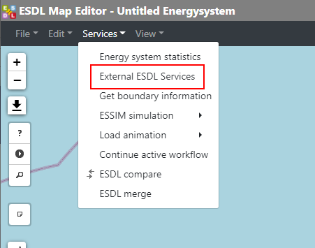
Click ‘External ESDL Services’ in the Services menu
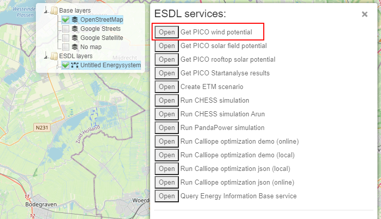
Select ‘Get PICO wind potential’
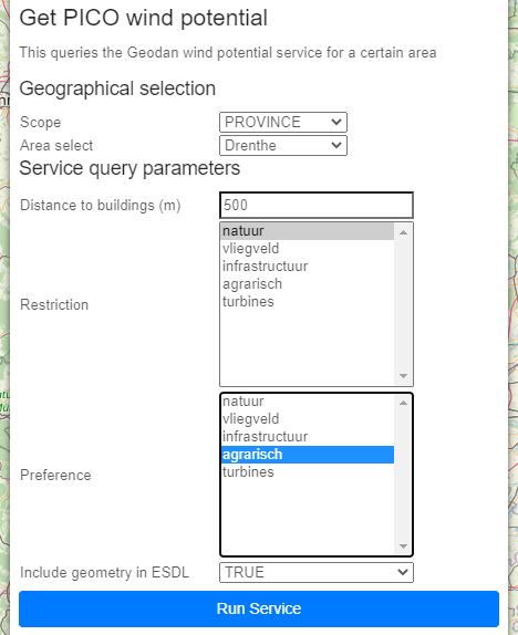
The following information is displayed
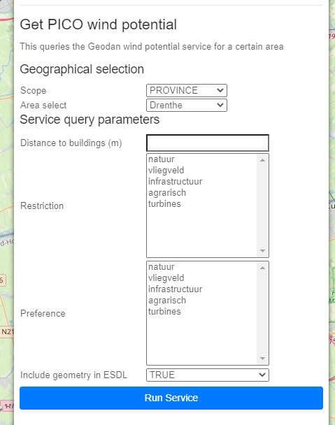
Fill in the required input parameters
We select the province of Drenthe
We want to know what the potential is, if we require a minimal distance of 500 meters between the wind turbines and the built environment
We don’t want to include areas that have been marked as ‘nature’ and do want to include any agricultural area
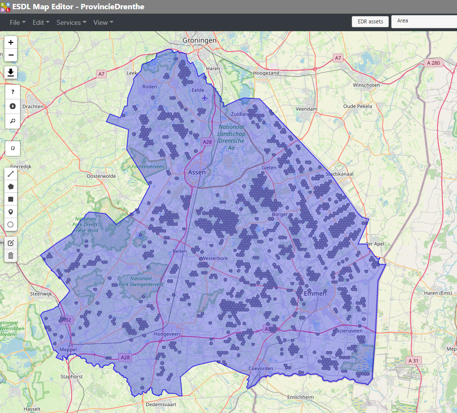
The result will look like the following picture. Each hexagon is a possible location for a wind turbine.
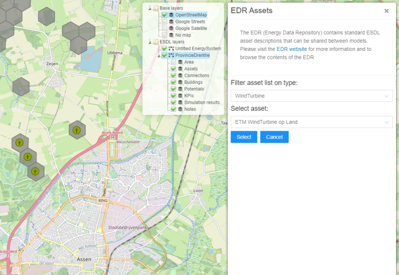
One possible option is to select an ‘ETM WindTurbine on Land’ asset from the Energy Data Repository (see Adding assets from the Energy Data Repository for more information).